GPS Lost Can Satellite Tech Reclaim Its Way?
Gps lost can the satellite technology find its way – GPS lost: can the satellite technology find its way? This exploration dives into the intricate workings of global positioning systems, examining the factors that can lead to signal loss and the strategies for recovery. From atmospheric interference to receiver malfunctions, we’ll uncover the complexities behind this crucial technology and consider its resilience.
Understanding GPS signal reception and degradation is crucial. Atmospheric conditions like the ionosphere and troposphere significantly impact signal strength. Interference from various sources, including electronic devices and natural phenomena, can also cause signal disruptions. The design of GPS satellites and the geometry of their constellation are vital for maintaining accuracy. The article will illustrate how receiver functionality plays a role, including signal processing, error correction, and the challenges of weak signal environments.
It will also cover scenarios where GPS signals are lost, how they are detected, and how they are regained, using troubleshooting steps. Alternative positioning systems like GLONASS and Galileo are discussed, highlighting their strengths and weaknesses and the possibilities of combining technologies for enhanced accuracy. Finally, we will delve into the extensive applications of GPS in various industries and daily life, emphasizing its critical role in navigation and other tasks.
GPS Signal Reception and Degradation
Global Positioning System (GPS) relies on a network of satellites broadcasting precise signals to receivers on Earth. However, several factors can degrade the quality and strength of these signals, impacting accuracy and reliability. Understanding these factors is crucial for developing robust GPS applications and mitigating potential errors.
Factors Affecting GPS Signal Strength
Several factors can influence the strength and quality of GPS signals, leading to signal degradation. These include atmospheric conditions, interference from various sources, and receiver limitations. The interplay of these factors determines the overall performance of GPS systems.
- Atmospheric Effects: The ionosphere and troposphere, layers of the Earth’s atmosphere, can significantly affect GPS signal propagation. The ionosphere, composed of charged particles, distorts the signal’s path, while the troposphere, containing water vapor, causes signal delays. These effects vary based on factors like solar activity and weather patterns.
- Interference: Various types of interference can disrupt GPS signals. Electromagnetic interference from radio signals, power lines, or other electronic devices can degrade signal quality. Furthermore, intentional jamming, used in some security or military applications, can completely block GPS signals. Man-made structures, dense foliage, and urban canyons can also cause signal blockage or attenuation.
- Receiver Limitations: The quality and sensitivity of the GPS receiver also play a critical role in signal reception. Poor receiver design, insufficient antenna gain, or interference within the receiver itself can affect signal quality. The receiver’s ability to process the received signals and extract the required information is also crucial.
Mitigation Strategies
Various techniques are employed to mitigate signal degradation issues. These techniques aim to minimize the impact of atmospheric effects and interference, ensuring the accuracy and reliability of GPS data.
- Atmospheric Modeling: Sophisticated models are used to predict and account for ionospheric and tropospheric effects. These models incorporate data on solar activity, weather patterns, and other relevant factors to compensate for the distortions introduced by the atmosphere.
- Interference Mitigation Techniques: Advanced signal processing techniques can help identify and mitigate interference. Techniques like filtering and signal enhancement algorithms are used to reduce the impact of interference on the received signals.
- Receiver Enhancement: Improved receiver designs and enhanced antenna technologies are crucial in improving signal reception. These improvements can increase sensitivity, reduce noise, and improve the ability to overcome signal degradation effects.
Comparative Analysis of Signal Reception Scenarios
| Scenario | Atmospheric Conditions | Interference | Receiver Quality | Signal Strength |
|---|---|---|---|---|
| Urban Canyon | Moderate Tropospheric Delay, Ionospheric Distortion | High Interference (EMI, Buildings) | Moderate Receiver Sensitivity | Low |
| Rural Area | Low Tropospheric Delay, Moderate Ionospheric Distortion | Low Interference | High Receiver Sensitivity | High |
| Mountainous Terrain | High Tropospheric Delay, Moderate Ionospheric Distortion | Moderate Interference (Obstacles) | Moderate Receiver Sensitivity | Medium |
| Under Dense Canopy | Low Tropospheric Delay, Low Ionospheric Distortion | High Interference (Blockage) | Moderate Receiver Sensitivity | Very Low |
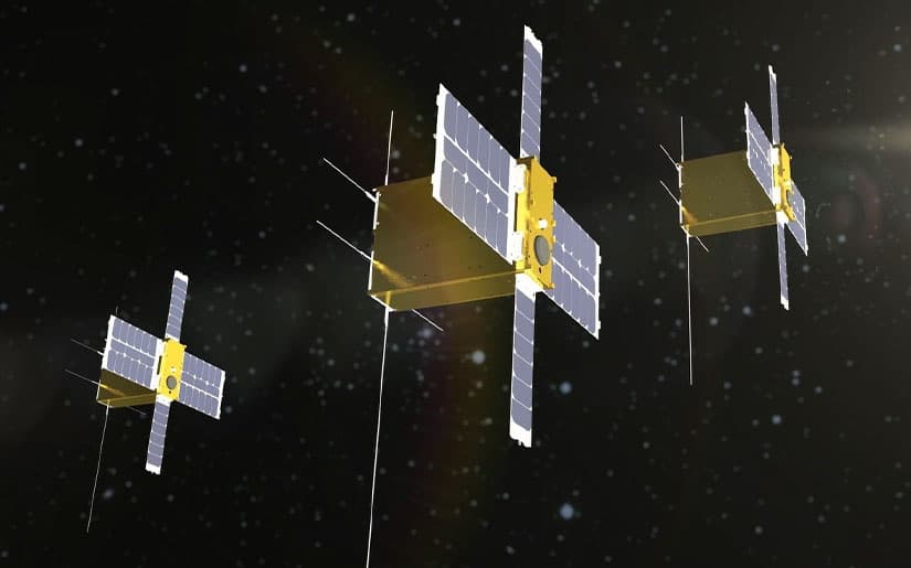
Satellite Constellation and Geometry
The GPS system relies on a network of satellites orbiting the Earth. Understanding the arrangement and positioning of these satellites is crucial for accurate positioning. The precise geometry of the satellite constellation directly impacts the quality of GPS signals received by users and, consequently, the accuracy of location calculations. A well-distributed constellation provides stronger signal reception and more precise positioning.The arrangement of satellites in space significantly affects how accurately a GPS receiver can determine its location.
The ideal scenario involves satellites strategically positioned to minimize errors in the calculation of distances. These calculations are fundamental to GPS’s functioning, and the positioning of satellites plays a vital role in reducing errors and ensuring the accuracy of the system.
Satellite Constellation Significance
A carefully planned satellite constellation is paramount to maintaining GPS accuracy. The constellation’s design ensures that at least four satellites are visible from any point on Earth at any given time. This visibility is necessary to calculate a user’s position through triangulation. A scattered distribution of satellites would lead to signal dropouts and significant errors in location.
A well-maintained constellation ensures continuous signal reception, enhancing the accuracy and reliability of the GPS system.
Impact of Satellite Geometry on Signal Reception
Satellite geometry directly influences signal reception and positioning accuracy. The distribution of satellites affects the signals’ strength and quality. A geometrically favorable configuration results in more precise positioning, while a less optimal configuration can lead to errors. These errors can stem from various factors, including signal strength and the time taken for signals to travel from the satellites to the receiver.
Visual Representation of Different Satellite Configurations
Imagine a map of the Earth. A good satellite configuration would have satellites evenly distributed across different orbital planes, ensuring visibility from most points on the Earth. This would result in a consistent signal strength and a more precise position calculation. Conversely, if the satellites were clustered in a particular area of the sky, the accuracy would be significantly reduced in areas not covered by the clustered satellites, as there would be fewer visible satellites.
A highly skewed distribution could lead to a significant error in the position calculations.
Factors Influencing Satellite Geometry, Gps lost can the satellite technology find its way
| Factor | Description |
|---|---|
| Satellite Altitude | Higher altitude satellites provide a wider coverage area but introduce longer signal travel times. |
| Satellite Spacing | The separation between satellites impacts signal strength and the ability to resolve ambiguities in the calculation. |
| Satellite Orbital Planes | The planes in which satellites orbit influence the number of visible satellites at any given time. |
| Satellite Clock Accuracy | Precise satellite clocks are crucial for accurate time measurements, which directly impact positioning accuracy. |
Impact of Configuration Change on User Location
A change in the satellite configuration can drastically impact a user’s ability to locate their position. For example, if a significant portion of the satellite constellation is lost due to a malfunction or a debris collision, the accuracy of the positioning would degrade considerably. A user in an area with fewer visible satellites would experience a larger error margin.
The quality of the positioning data would deteriorate, and the user’s location would be less precise.
GPS Receiver Functionality
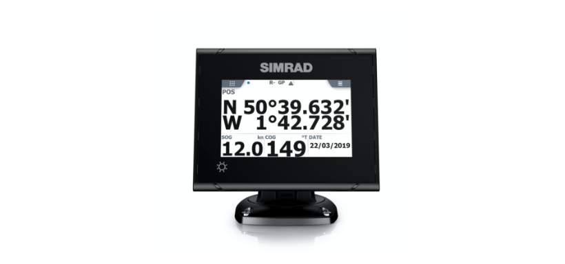
GPS receivers are the crucial link between the satellite signals and the user’s desired location information. They are sophisticated devices capable of precisely determining position, velocity, and time by processing the signals transmitted from satellites in the GPS constellation. Understanding their functionality is key to appreciating the intricate technology behind GPS.
Processing GPS Signals
The process of extracting position information from GPS signals involves several steps. First, the receiver acquires the signals from multiple satellites. This involves identifying the unique signal characteristics of each satellite. Once acquired, the receiver measures the time it takes for the signal to travel from the satellite to the receiver. This time difference, known as the pseudorange, is used to determine the distance from the receiver to each satellite.
GPS signals can sometimes get lost, leaving you wondering if satellite technology can still pinpoint your location. Similar to how Symantec is proactively defending against mobile malware with their latest handheld security measures, symantec preempts virus fight on handhelds , the intricate network of satellites working together should be able to recover your position even in challenging environments.
This intricate system of global positioning is a testament to how reliable satellite technology can be, even when your handheld device encounters difficulties.
Because of inaccuracies in the satellite’s clock and receiver’s clock, these measurements are not exact. Subsequent steps involve precise estimation of the satellite clock errors, receiver clock errors, and atmospheric delays to enhance the accuracy of these distances. Finally, the receiver utilizes sophisticated mathematical algorithms to triangulate the position from the estimated distances to multiple satellites.
GPS signals can sometimes get scrambled, leaving you wondering if satellite technology can truly pinpoint your location. This reminds me of the complex battles in the tech world, like the SCO vs IBM saga. This fascinating historical clash of interests, which explored the complexities of open-source software and proprietary systems, SCO vs IBM the other reality highlights how deeply intertwined technology and business decisions can be.
Ultimately, though, even with these intricate issues, the core question of how satellite systems ensure accuracy in the face of potential interference remains a compelling one.
Types of GPS Receivers
GPS receivers vary in their capabilities and complexity. Basic receivers, often found in consumer devices like smartphones, are designed for straightforward location determination. These receivers are typically less accurate and may have limited functionalities. More sophisticated receivers, used in professional applications like surveying or mapping, offer higher accuracy and enhanced functionalities, such as real-time kinematic (RTK) positioning, which allows for centimeter-level accuracy.
Examples include those employed in precise agricultural applications for guiding tractors and in high-precision surveying.
Challenges in Weak Signal Environments
GPS receivers face challenges in environments with weak signal strength, such as dense urban canyons, deep forests, or areas with significant multipath interference. Multipath interference occurs when the signal reflects off objects before reaching the receiver, causing errors in the measured time of arrival. In these situations, the receiver must use sophisticated signal processing techniques to mitigate the impact of these errors and to distinguish the direct signal from the reflected signals.
Error Correction Mechanisms
Error correction mechanisms are essential for improving the accuracy of GPS positioning. These mechanisms often involve the use of differential GPS (DGPS) techniques, which use a reference station to correct for errors in the satellite signals and receiver clocks. Differential GPS significantly improves accuracy, particularly in environments with weak signals. Another example is using Precise Point Positioning (PPP), which uses a combination of satellite data and precise models of atmospheric conditions to refine the positioning calculation.
Key Components of a GPS Receiver
| Component | Function |
|---|---|
| Antenna | Captures the radio signals from the satellites. |
| Signal Processing Unit | Receives the signal from the antenna, filters out noise, and determines the signal’s time of arrival. |
| Clock | Measures the time of arrival of the signals with high precision. |
| Microprocessor | Processes the data from the signal processing unit and clock to calculate the receiver’s position, velocity, and time. |
| Memory | Stores the ephemeris data of the satellites, atmospheric models, and other relevant information. |
| Output Interface | Provides the calculated position, velocity, and time information to the user. |
Lost Signal Scenarios and Recovery Strategies: Gps Lost Can The Satellite Technology Find Its Way

Losing a GPS signal can be frustrating, especially when relying on accurate location data. Understanding the reasons for signal loss and the strategies to regain it is crucial for anyone using GPS technology. This section delves into the various scenarios leading to signal loss and the effective recovery methods available.
Signal Loss Scenarios
GPS signal degradation or loss can stem from numerous factors. Obstructions, environmental conditions, and receiver issues are common culprits. A building or dense foliage can block the signals from the satellites, leading to signal loss. Similarly, heavy rainfall or atmospheric disturbances can significantly affect signal quality. Furthermore, GPS receivers can malfunction, leading to a failure to acquire or maintain a lock on the satellites.
In extreme cases, intentional jamming or interference can disrupt GPS signals.
Signal Detection Mechanisms
GPS receivers continuously monitor the strength and quality of the signals from the satellites. A key component is the signal-to-noise ratio (SNR). When the SNR drops below a threshold, the receiver flags a signal loss. The receiver also monitors the number of satellites visible and the accuracy of the calculated position. If these metrics fall outside acceptable ranges, the receiver may identify a signal loss condition.
Signal Recovery Strategies
Several strategies are employed to regain a lost GPS signal. The most common involves moving the GPS device to an area with a clear view of the sky. This allows the receiver to acquire signals from more satellites. Furthermore, adjusting the antenna’s position or orientation can improve signal reception. In cases of temporary interference, allowing the device to cycle or restart can sometimes resolve the issue.
Troubleshooting Steps
Troubleshooting a lost GPS signal requires a systematic approach. The following table Artikels a step-by-step procedure to help regain the signal.
| Step | Action | Expected Outcome |
|---|---|---|
| 1 | Verify Satellite Visibility | Identify visible satellites using the GPS device’s display. |
| 2 | Move to Open Area | Move the device to a location with an unobstructed view of the sky. |
| 3 | Adjust Antenna Orientation | Adjust the antenna’s position and orientation to maximize signal reception. |
| 4 | Restart the Device | Restart the GPS receiver to clear any temporary glitches. |
| 5 | Check for Obstructions | Inspect the area for any potential obstructions like trees, buildings, or foliage. |
| 6 | Review Environmental Conditions | Assess the weather conditions for any interference from rain, snow, or other atmospheric phenomena. |
| 7 | Contact Support (if necessary) | Seek technical assistance if the issue persists. |
Alternatives and Complementary Technologies
Beyond GPS, a suite of alternative and complementary positioning systems offer diverse capabilities and potential benefits. These systems often address specific limitations of GPS, like signal blockage or reliance on a specific constellation. Understanding their strengths and weaknesses is crucial for selecting the optimal system for a given application.Different positioning technologies are not mutually exclusive and can be combined to enhance accuracy and reliability.
Hybrid systems leveraging multiple signals can provide improved positioning in challenging environments, leading to more robust navigation solutions.
Alternative Positioning Systems
Several alternative global navigation satellite systems (GNSS) exist, each with its own strengths and weaknesses. Understanding these differences is essential for selecting the right system for a particular task.
- GLONASS (Russia): GLONASS is a global satellite navigation system, similar in concept to GPS. Its satellite constellation provides a complementary signal source for enhanced accuracy and availability. It’s particularly useful in areas with GPS signal blockage. A key strength is the increased number of satellites visible at any given time, leading to more robust positioning in challenging conditions.
However, its accuracy can be slightly lower compared to GPS in open sky conditions. The recent advancements in GLONASS signal processing and satellite technology are further improving its performance and expanding its application areas.
- Galileo (Europe): Developed by the European Union, Galileo is a GNSS system designed to provide high-accuracy and robust positioning services. Galileo’s design emphasizes enhanced security and civil applications. A strength of Galileo is its planned future expansion, allowing for more extensive coverage and potential improvements in accuracy and reliability. A possible limitation might be the potential cost of integration for some applications.
- BeiDou (China): BeiDou is a global navigation satellite system developed by China. It offers a significant improvement in satellite coverage, especially in regions where GPS or GLONASS signals are weaker. The potential to provide real-time positioning and navigation data is a considerable advantage. A weakness could be its relative novelty compared to GPS or GLONASS, leading to less widespread integration and support in some applications.
Ever wondered if a GPS signal gets lost, can the satellite network still figure out where you are? It’s a fascinating question, especially considering the recent advancements in open-source technology, like the initiative by Japanese developers against Microsoft’s proprietary systems. Japan strikes against Microsoft with open source shows a powerful shift in the tech landscape, potentially leading to more robust and independent satellite navigation systems.
Ultimately, the question of lost GPS signals and satellite technology’s ability to find its way remains a critical aspect of modern navigation.
Comparison of Navigation Technologies
Comparing GPS, GLONASS, Galileo, and BeiDou reveals varying characteristics that influence their suitability for different scenarios.
| System | Strengths | Weaknesses |
|---|---|---|
| GPS | Widely available, mature technology, high accuracy in open sky conditions | Signal blockage can affect accuracy, limited availability in certain areas |
| GLONASS | Complementary signals, improved availability in challenging environments | Potential for slightly lower accuracy in open sky compared to GPS |
| Galileo | High accuracy, enhanced security features, focus on civil applications | Relatively newer system, potential integration costs for some applications |
| BeiDou | Improving coverage, particularly in areas with limited GPS or GLONASS visibility | Relative novelty compared to established systems, potential integration challenges in some applications |
Hybrid Systems
Using multiple GNSS systems simultaneously enhances accuracy and reliability. Combining signals from different constellations, like GPS and GLONASS, allows for better positioning, particularly in environments where signal degradation or blockage is common. The improved accuracy results from the combination of diverse satellite geometries and signal characteristics.
Using a hybrid approach can increase the number of visible satellites, leading to a higher probability of successful location determination. The combined use of multiple constellations improves the robustness of the system against signal degradation or interference.
Applications and Impact
GPS, a seemingly simple system, has profoundly impacted our lives, revolutionizing navigation, communication, and numerous industries. From precise farming to emergency response, the ubiquitous nature of GPS has become integral to modern society. Its accuracy and reliability have made it a cornerstone of technological advancement, affecting countless people and businesses worldwide.GPS is more than just a navigation tool; it’s a platform for data collection, real-time monitoring, and precise positioning.
This ability to pinpoint location with extraordinary accuracy has opened doors to a myriad of applications, transforming industries and shaping our daily routines. Its impact is multifaceted, from enhancing personal travel to enabling critical operations in complex environments.
GPS in Navigation
GPS has fundamentally changed how we navigate. Its accuracy and widespread availability have made it an indispensable tool for travelers, both personal and professional. From planning routes to tracking vehicles in real-time, GPS enables efficient and precise movement. For instance, GPS-enabled navigation apps provide turn-by-turn directions, avoiding traffic congestion, and calculating travel times. This level of detail was unimaginable before the advent of GPS.
Furthermore, hikers and explorers benefit greatly from GPS devices that pinpoint their location and guide them along trails.
GPS in Transportation
GPS technology plays a vital role in various transportation sectors. In logistics, real-time tracking of shipments enables efficient delivery and reduces delays. GPS-enabled vehicle tracking systems help optimize routes, monitor fuel consumption, and improve fleet management. In aviation, GPS aids pilots in precise navigation, enhancing safety and efficiency. Furthermore, GPS contributes to the safety and security of public transportation systems by enabling real-time tracking of buses, trains, and other vehicles.
GPS in Precision Agriculture
The precision agriculture sector benefits significantly from GPS technology. GPS-guided tractors and other equipment can precisely apply fertilizers, pesticides, and water, minimizing waste and maximizing crop yields. Furthermore, GPS technology enables farmers to monitor crop health and soil conditions in real-time, allowing for targeted interventions and optimized resource management.
GPS in Emergency Services
GPS technology is a critical component of emergency response systems. It allows for the rapid and accurate location of victims in search and rescue operations. Emergency vehicles can use GPS to optimize routes to reach the scene quickly. The precise location information provided by GPS enables dispatchers to send the appropriate resources to the exact location of an emergency.
GPS in Other Applications
GPS applications extend beyond transportation and agriculture. In surveying and mapping, GPS provides accurate and detailed measurements for creating precise maps and plans. In surveying and engineering projects, GPS helps determine precise coordinates and elevations. Furthermore, in the field of scientific research, GPS is crucial for tracking animals, monitoring environmental changes, and conducting various scientific experiments.
| Application | Benefits |
|---|---|
| Navigation | Improved efficiency, reduced travel time, enhanced safety |
| Transportation | Optimized routes, reduced fuel consumption, improved fleet management |
| Precision Agriculture | Reduced waste, maximized crop yields, optimized resource management |
| Emergency Services | Rapid and accurate location of victims, optimized response times |
| Surveying and Mapping | Accurate and detailed measurements, precise maps and plans |
Concluding Remarks
In conclusion, the resilience of GPS technology is remarkable. While signal loss can occur due to a multitude of factors, from atmospheric disturbances to receiver issues, various strategies and alternative technologies exist to mitigate these challenges. Ultimately, the accuracy and reliability of GPS are essential for numerous applications, making it a crucial component in modern life. Understanding these intricacies is key to harnessing the full potential of this powerful technology.